
Looking Up Chula Vista Neighbors
A block-level neighbors search begins with a reproducible land definition: the target parcel, parcels touching its side or rear, parcels opposite the street segment between the nearest intersections, and corner parcels whose access may face another street. For Chula Vista neighbors, that is a geography rule, not a claim about social ties. CVMapper establishes the land relationship. The assessor, recorder, permits, and historical directories add different kinds of evidence.
| Source | Block Evidence | Access and Limit |
|---|---|---|
| CVMapper and SanGIS | Adjoining APNs, situs, ZIP, lot geometry, planning and hazard fields | Free map; no public owner layer |
| Assessor maps and roll | Boundaries, dimensions, assessment, exemption, adjoining parcels | Web map; owner details by phone or kiosk |
| Recorder kiosk | Deeds, liens, maps, and parties for each APN | In person; images and copies have access rules |
| Accela permits | Project numbers, status, dates, inspections, named professionals | Free search from 1992; older records by request |
| Voter data | Residence information only in a permitted file | No public street browser; purpose and security rules |
| Community and directories | Public civic contacts or historical household clues | Member rosters and private lists are not public |
Owners are easier to connect to parcels than occupants are to homes. A mailing address can differ from situs, a property can have several units, and a protected person may be absent from ordinary disclosure. The source table shows what a block search can support without turning an owner clue into a household claim.
Mapping a Chula Vista Block
Use CVMapper or SanGIS to walk outward from a known parcel. Search or click the starting address, zoom until parcel outlines show, and click touching and nearby polygons. Pan along both sides of the street segment. Corner, rear, and flag lots make postal-number adjacency unreliable, so record the APN, situs, subdivision or SPA, ZIP, lot shape, and map link for every selected parcel.
- Locate the starting parcel and save its APN, situs, ZIP, and legal or planning clues.
- Click each touching side or rear parcel, the opposite street face, and relevant corner parcel.
- Use the assessor phone or kiosk for owner and mailing fields, keeping those separate from occupancy.
- Use recorder kiosk documents and Accela permits to add dated land and project evidence.
- For a whole named street, move to the Chula Vista street directory chain instead of treating the block method as a street browser.
The city parcel service can return many records, but a narrow, reproducible set is easier to review. A modern parcel may result from a split or condominium map. Compare recorded-map references before connecting one building to one person. That discipline keeps Chula Vista neighbors tied to mapped parcels rather than guesses from a street view.
Map Chula Vista Neighbors in GIS
SanGIS and CVMapper establish the physical block. There is no documented public radius or buffer control that names every owner. Start with a parcel, zoom until outlines are readable, and click the polygons that touch or sit across the defined street segment. Save each APN and address before moving to the next source. A map click establishes land adjacency, not a social relationship.
Note: Define the block before collecting records; changing from touching parcels to a street number range changes the result set and its privacy implications.
For each nearby parcel, capture the ZIP, subdivision or SPA, lot geometry, planning and hazard attributes, and the CVMapper deep link. Then use the assessor phone or kiosk for owner and mailing details, the recorder kiosk for documents, and Accela for permits. Rear lots, corner access, common parcels, and condominium maps can make a visually close property legally separate.
- Touching parcel
- A parcel sharing a mapped boundary with the starting parcel.
- Opposite parcel
- A parcel across the street segment between the nearest intersections, not necessarily across the full block.
- APN
- The county parcel identifier that lets land records be matched across maps and offices.
- SPA
- A specific planning area label that helps explain planned-community geography.
Chula Vista Neighbor Owner Alerts
San Diego Owner Alert is a parcel-safety tool that can add a timely signal to neighbors research. It can help Chula Vista neighbors notice a filing tied to a monitored parcel without turning the alert into a household list. Enrollment is free and can monitor up to ten indexed names and ten APNs per email. The alert sends a document number and link after a matching instrument is indexed. It cannot block a filing or show the full document, so a notice must be checked at the official index or kiosk.
The San Diego County Owner Alert service shows the county's notification route for indexed names and APNs.
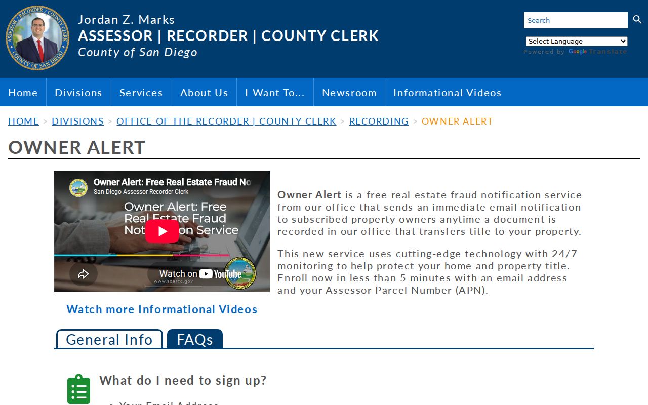
For a suspected forged instrument, verify the document at ARCC and contact the Real Estate Fraud Unit at 619-531-3552 or RealEstateFraudComplaints@sdcda.org. An alert belongs to the parcel and recorded name. It does not identify the neighbors living nearby.
Chula Vista Block Permit Records
Accela can add a dated project layer to the block. Search each selected address or APN and note permit type, number, status, application or issue date, final date, contractor, inspections, and related records. A run of permits can show a remodel pattern, new construction, solar work, or a unit change across nearby parcels.
Online building history begins after 1992. Earlier projects need a Development Services request with address, APN, permit number if known, and document type. Plan-copy rules can require authorization. A project participant is not automatically a current owner, past resident, or neighbor. Keep the permit's date and role beside every name.
Permits answer construction history; county deeds answer ownership history. Keeping that comparison explicit prevents a block map from becoming a list of unsupported household claims.
Chula Vista Neighbor Voter Rules
San Diego's self-lookup asks for a house number, birth date, street name, street type, direction when present, and ZIP. It verifies one person who supplies their own details. The form cannot enumerate every registered voter on a block. A full voter-file application requires an original signature, a defined purpose under Elections Code section 2194 and implementing rules, secure storage, and restrictions on sharing, reuse, commercial use, or harassment.
This matters when a block map looks incomplete. Safe at Home participants and protected voters receive special handling. Registration list maintenance can remove records after official information establishes a move, death, or ineligibility. None of these systems reveals ballot choices. A neighbor search should therefore use voter information only within its lawful, approved channel.
Note: A missing voter result can reflect privacy, eligibility, processing, or address mismatch; it cannot prove that no one lives at the parcel.
Chula Vista Neighbor Geography
Neighborhood names help orient a block, but the research did not locate an official citywide association directory or public membership roster. Chula Vista neighbors may describe the same block through a plan area, subdivision, or popular community name. Planning materials name geographies such as Otay Ranch Millenia, Eastern Urban Center, Bella Lago, EastLake III, Salt Creek and Rolling Hills, Otay Ranch Villages 9 through 11, University Innovation District, EastLake Business Center, Greens and Trails, and Freeway Commercial North. They are planning or community areas, not resident rolls.
| Community clue | What it can help establish |
|---|---|
| SPA or planned-community name | Planning geography and the likely city document trail |
| Public board or meeting notice | A civic contact or issue tied to the area |
| Neighborhood services | City contact route and public program information |
| Private association roster | Not a public source; use consent and the group's own access rules |
Note: A plan-area name helps route a civic question, but it is not a public roster of Chula Vista neighbors or association members.
Congregation directories, school lists, block-watch contacts, and private club rosters may exist, but they are not official neighbor databases. A public board officer or newsletter can support a civic-history question without authorizing a member search.
Official Chula Vista Neighbor Tools
Compiled neighbor tools may merge assessor, deed, marketing, and directory data. They can be useful as unverified leads, but they may label an owner as an occupant, attach one name to an apartment building, miss a death or move, or repeat a corrected address. The official chain is slower, yet each step has a custodian and a stated purpose.
| Official block research | Compiled neighbor result |
|---|---|
| GIS identifies touching land and APNs | May draw a radius without explaining the parcel rule |
| Assessor and recorder show narrow land or document facts | May merge owners, occupants, and old addresses |
| Permits and directories carry dates and roles | May hide source dates or publisher conventions |
For a Chula Vista block question, record the APN and document number first, then treat any compiled name as unverified until an official source supplies its date and role.
Privacy Limits for Chula Vista Neighbors
Public parcel records do not disclose every neighbor. Renters, household members, children, visitors, utilities, delivery accounts, school lists, and private association rosters are outside the ordinary land chain. Safe at Home participants use a substitute address, and protected officials or other protected residents may have home-address suppression. A missing person in a public result is not proof that the household is absent.
The Driver's Privacy Protection Act restricts DMV information. California voter data is available only for defined purposes, and a full file may not be republished, transferred, used commercially, or left unsecured. Community groups can offer public meeting notices or board contacts, but a public officer does not authorize publication of a membership list.
Personal safety awareness should use the narrowest source needed. A parcel map can show a route around a blocked sidewalk or a property boundary. A public city service contact can answer a neighborhood question. Neither calls for collecting names of every nearby household. If a record raises a safety concern, use the official agency or emergency route rather than trying to build a private watch list. That protects Chula Vista neighbors and keeps the research within its proper purpose.
Lawful use. Neighbor lookups in Chula Vista are for getting to know a block, reconnecting, and personal safety awareness. Do not use records to watch, stalk, harass, intimidate, or harm anyone.