
Finding Chula Vista Street Records
A Chula Vista street directory begins with an address, but an address is not a household record. For the Chula Vista street directory, preserve the address exactly as written, including its unit, direction, and street type. The city parcel map can connect the location to an APN and legal description. The assessor can add a current assessment and, by phone or kiosk, ownership information. The recorder then supplies a deed or lien trail. Permits add a construction timeline. Historical criss-cross volumes may show a householder at a prior date.
Use the chain below in order. It separates land identity from people evidence and leaves a clear trail when one source has no match. The county voter lookup belongs later and only for the person who can complete the identity-gated form. It cannot enumerate every voter along a street.
- Run the address through the San Diego secured assessment roll search and capture the APN, parcel facts, and any result notice.
- Open the parcel in CVMapper or SanGIS, confirm the situs and ZIP, and inspect adjoining geometry.
- Use the assessor phone line or a public ARCC kiosk when web ownership fields are suppressed.
- Search the recorder by the current party name online, or use the kiosk's APN mode and image access for the target parcel.
- Review Accela permits, the county tax search, the voter rules, and dated reverse directories according to the question.
That sequence produces a street record trail, not a promise that every person at every address will appear. Keep the APN, source, date, and record type beside every name.
Chula Vista Records by Street
Several San Diego County and Chula Vista systems accept an address or parcel, but they do not all describe the same person. The coverage map below keeps the roles separate. A deed party is connected to an instrument. A permit participant is connected to a project. A tax mailing name is connected to an account. A reverse-directory entry is connected to a publication date and publisher convention.
| Record Set | Keeper | Address Clue | Access |
|---|---|---|---|
| Secured assessment roll | San Diego ARCC | APN, assessment, exemption, address search | Web; phone or kiosk for owner data |
| Parcel maps and CVMapper | City and county GIS | Situs, ZIP, adjoining parcels, zoning and hazards | Free interactive viewers |
| Deeds, liens, and maps | San Diego Recorder and Archives | Parties, conveyance type, legal description, map continuity | Name web index; APN kiosk; older archive series |
| Secured and tax bills | Treasurer-Tax Collector | APN, bill account, installments, mailing address | Free APN or mailing-address search |
| Building permits | Chula Vista Development Services | Permit status, inspections, project dates, listed professionals | Accela online from 1992; older request |
| Voter information | San Diego Registrar | One person's residence match and election details | Self-lookup; file only with approved purpose |
| Criss-cross directories | Libraries and archives | Historical householder, business, phone, owner or renter mark | Digital and onsite collections by year |
The APN is the bridge. It can connect a map to an assessment record, a kiosk deed, a permit, and a tax account. The street name is a search aid, not a universal key. The Chula Vista resident lookup page handles the one-person cross-check when the street question turns into an identity question.
Note: An APN ties a map to land, while a recorder party name ties an instrument to a person or entity.
Normalize Chula Vista Street Names
False no-result messages often come from the address format. Chula Vista eZoning accepts an APN or a street number with street name, and its suffix key uses short forms such as Av, Bl, Ci, Ct, Dr, Ln, Lp, Pl, PW, Rd, St, Te, and Wy. Preserve the original spelling for historical work, then test the city's normalized suffix. In the county assessor form, omit direction, street type, and city when the instructions call for only number and street name.
Test the address as USPS writes it first. Then try the normalized street name, a number range, or street-name-only mode for a parcel without a number. A unit can matter in Accela even when the county parcel is shared. Keep both the formatted APN and the ten-digit form because CVMapper and county systems may display punctuation differently.
The Chula Vista eZoning lookup displays the APN or address starting point and the suffix conventions used by the city.
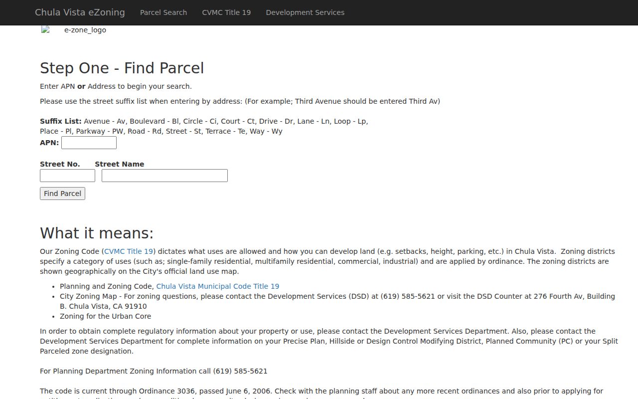
eZoning returns zoning information, not a resident list. Precise Plan, hillside, design-control, planned-community, and split-parcel questions may need Development Services confirmation. The same caution applies to a street directory: location data identifies a land record before it identifies a person.
Chula Vista Street Assessor Fields
The secured assessment roll is the address workhorse for Chula Vista. Its dropdown offers Parcel Number, Address, or Street Name. An APN needs the county's punctuated form. Address mode uses a number and street name. Street-name-only mode is for parcels without a number. The online result shows assessed value, exemption amount, factored base-year value when a temporary Proposition 8 reduction applies, reason for change, roll year, and an informational notice. It is not a market valuation or a full household card.
| Assessor control | Format and use |
|---|---|
| Search mode | Parcel Number, Address, or Street Name |
| APN | Use at least eight digits with county punctuation; confirm the full parcel identifier |
| Address | House number plus street name; omit direction, type, and city when instructed |
| Street Name | Useful for a parcel with no numbered situs address |
| Result notice | Assessment, exemption, base-year, roll-date, and print information |
Online ownership is suppressed in the county's public web workflow. Phone and kiosk access can add ownership, mailing address, sales listing, building and land characteristics, historical tax information, and the online property index. For a Chula Vista street directory, that phone or kiosk step prevents a web suppression from being mistaken for an empty parcel. ParcelQuest adds maps and characteristics, but its free use is limited to 25 searches per rolling 30 days before subscription. A map popup may show geometry without an owner.
Note: A tax mailing address can cluster correspondence records, but it cannot establish that the named account holder lives at the parcel.
Walk Chula Vista Parcels in GIS
CVMapper and the SanGIS parcel viewer turn a street into a visible sequence of land records. Search or click the starting parcel, zoom until boundaries are clear, and inspect the same and opposite street faces. A popup can provide APN, situs, ZIP, property description, acreage, units, zoning, general-plan area, floodplain, fire-hazard, methane, subdivision, and planning attributes. It does not supply a public owner or mailing field.
For a block or long street, record one APN at a time. Corner, rear, and flag lots can make postal adjacency misleading. A subdivision or condominium may split one visible building into many legal interests. Feed each selected APN to the assessor phone or kiosk, recorder kiosk, and Accela rather than treating the map as the final answer.
- APN
- The assessor's parcel number, an administrative land identifier that survives many address changes.
- Situs address
- The physical location assigned to a parcel, not its tax mailing destination.
- Plat or recorded map
- A filed map that helps connect lots, blocks, subdivisions, and later parcel splits.
- Parcel polygon
- A mapped land shape showing geometry and boundaries, not a social relationship between people.
When old street numbers do not align, the legal description and recorded map are the bridge. Preserve the parcel's map reference before moving to deeds or directories.
Trace Deeds Along a Chula Vista Street
The recorder does not index deeds primarily by street. San Diego's online Acclaim index searches a grantor or grantee name from 1970 to the present and updates daily, though a new filing may take 24 to 48 hours to appear. Online results are index data without downloadable images. Chula Vista kiosks retain APN searching and image access, and the archive holds older indexes, deeds, maps, and related series.
For a current parcel, start with the APN from GIS or the assessor. At a kiosk, find the latest conveyance and record the document number, recording date, grantor, grantee, APN, and legal description. Online, search the current owner as grantee. Then search the seller as the earlier grantee. Repeat with spouse, trust, entity, and pre-2012 abbreviation variants. A grant deed or quitclaim can convey an interest; a deed of trust secures financing; a reconveyance releases it; a lien records a claim. Do not treat every recorded instrument as a transfer of title.
Index access is free. Copy orders and certification carry county fees, and online copy orders require an account; staff normally print the next business day and mail by USPS. The Chula Vista branch, main San Diego office, and Santee Archives provide different access channels. The county's free Owner Alert can notify up to ten names and ten APNs, but it cannot block a filing or reveal the instrument contents.
Chula Vista Permit History by Address
Accela is the street directory's time layer. Search one address, APN, permit number, or state contractor license number. The Building search can accept a street number, direction, name, type, unit, city, state, ZIP, parcel, permit type, date range, business name, or contractor license. Results can show permit number and type, address, status, application or issue date, final date, and listed professional. Completed inspections can date construction activity or an alteration.
Use the portal for permits issued after 1992. For an older house, request building records from Development Services with the address, APN, known permit number, and document type. Plan copies may require the Health and Safety Code section 19851 process. The city clerk's public-records request center is a fallback for records not posted. Neither applicant nor contractor status proves that the person lived at the address.
The Chula Vista Accela property lookup shows how an address search can connect permits and parcel clues.
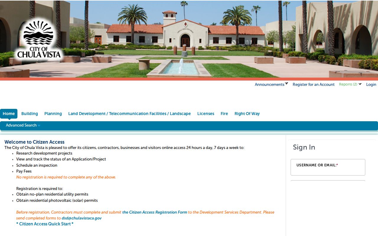
Compare the permit date with a deed recording date, tax roll date, and directory edition. That comparison can narrow when a change occurred without pretending to know the exact move date.
Chula Vista Reverse Directories
Printed Haines and Polk criss-cross volumes are the address-first part of the Chula Vista street directory. Read both sides of a street and note cross streets, numbered addresses, householder or business, homeowner or renter marks, and telephone fields when present. The collections are snapshots. A publication lag means a change happened between observations, not necessarily on the date printed on the page.
Research identifies Haines evidence for 1971, 1975, 1979, 1982, and 1986. Other address evidence appears in 1960 and 1965 Polk volumes and selected Polk or environmental-archive editions from 1992, 1995, 2000, 2005, 2010, 2014, and 2017. The Chula Vista Public Library local-history room, San Diego Central Library California Collection, city environmental archive, and broader digital directory shelves each cover different years. Confirm the exact volume before citing an entry.
Older entries may use rural syntax such as a direction and cross-street distance. Preserve the printed form, translate it cautiously, and test the APN or map rather than forcing it into a modern geocoder. The historical collections are treated fully on the Chula Vista city directory page. A street directory assembled from those older clues should retain the original wording beside the modern address.
Note: Directory publication lag means two editions bracket a move; neither issue supplies the exact day a household changed.
Chula Vista Street Address Changes
Chula Vista grew east through EastLake, Rancho del Rey, and Otay Ranch while older west-side streets carry deeper directory and census evidence. Annexation, subdivision, a renamed road, a new unit, or a planning boundary can cause a modern search to miss an older record. The city assigns or coordinates new addresses during development review and relays the issued address to utilities, USPS, schools, the assessor, the Sheriff, and city departments. Those systems do not update at the same moment.
Use APN, legal description, subdivision name, recorded map, and event-date address together. A current ZIP cannot prove that an older directory used the same city name. A mailing address is correspondence evidence, not the parcel situs. If a property trail crosses a split, compare successive maps and preserve the old lot and block wording before returning to the recorder or library shelf.
Note: The durable street key is usually the APN plus legal description, while the postal address is the clue that starts the search.
Limits of a Chula Vista Street Directory
A street directory cannot show every occupant, visitor, child, lodger, or person who receives mail at a property. The assessor and recorder describe land and recorded interests. The voter system verifies one person rather than opening a block list. DMV information is restricted under the Driver's Privacy Protection Act, and utility, delivery, school, and private association rosters are not part of the public street chain.
Even an address match needs care. A corner parcel may face another street. A flag lot may sit behind a different number. A condominium parcel may contain several legal interests. A mailing address may point away from the situs. A protected person may use a substitute address or have a suppressed record. These are ordinary reasons for a missing or surprising result, not proof that a record is wrong.
Lawful use. Chula Vista address records are for personal, lawful research. Do not use them to stalk, harass, intimidate, or harm any person; public access is not permission for repeated unwanted contact.